Ocean Infinity Search Tracker
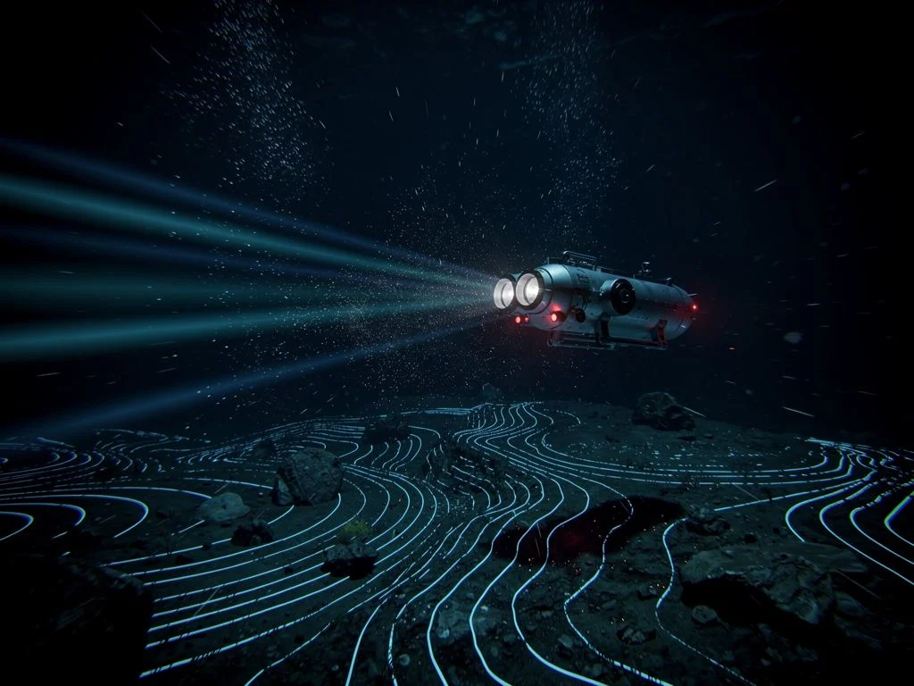
Ocean Infinity's renewed search for MH370 concluded on March 8, 2026, the 12th anniversary of the aircraft's disappearance. Despite deploying its most advanced autonomous underwater vehicle technology across 28 days of operations, no wreckage was found. More than 250,000 km² of seabed has now been searched across all efforts without locating the aircraft.
Search concluded March 8, 2026. No wreckage found. 7,571 km² searched across 28 days of operations.
Last updated: March 16, 2026
"We can say with confidence that it isn't where we looked. That matters; it brings clarity. The scale of the challenge both geographically and technologically is almost impossible to comprehend."
Oliver Plunkett, CEO, Ocean Infinity (March 8, 2026)
Reactions
Malaysia Air Accident Investigation Bureau
Confirmed the "search has not yielded any findings that confirm the location of the aircraft wreckage."
Voice370 (Families Group)
Urged the government to extend Ocean Infinity's contract: "The government pays nothing unless the aircraft is found. Any request by Ocean Infinity to extend the search contract should therefore be granted without hesitation." The group added: "We will never give up."
Search Zone Overview
The 2025–2026 search covered 7,571 sq km along the 7th arc, informed by post-2018 drift analysis and Bayesian probability studies. Three competing crash location predictions are shown. The searched area found no wreckage.
Search Phases
The 2025–2026 search was conducted in two operational phases totalling 28 days at sea, before Ocean Infinity announced the conclusion of operations on March 8, 2026.
Initial deployment. Equipment testing and first survey passes along the 7th arc. Brief operational window before vessel was redeployed.
Primary search operations using the most advanced AUV technology Ocean Infinity has ever deployed. Systematic survey coverage along the 7th arc between approximately 33°S and 36°S, focusing on priority segments identified by drift analysis. Vessel departed the search area on January 23, 2026.
On the 12th anniversary of MH370's disappearance, Ocean Infinity announced the conclusion of the search. No wreckage was found. The vessel was redeployed for other commercial work. The contract runs until June 2026 but a return is unlikely due to approaching Southern Hemisphere winter and deteriorating sea conditions. Ocean Infinity stated it is "continuing to work with the Malaysian Government in the hope of being able to return when circumstances allow."
Competing Predictions
Multiple independent research groups proposed crash locations along or near the 7th arc. The 2025–2026 search zone was informed primarily by the first two analyses. Neither prediction was validated; no wreckage was found in any of the searched areas.
Full drift analysis of confirmed MH370 debris combined with reverse-drift modelling. Cross-referenced with Inmarsat BTO/BFO data to refine the 7th arc impact point.
Australian Defence Science and Technology Group (DSTG) Bayesian analysis incorporating aircraft performance models, satellite data, and drift studies. Identifies a probability hotspot along the 7th arc.
Weak Signal Propagation Reporter (WSPR) network analysis. Uses amateur radio signal anomalies to triangulate the aircraft position. Methodology is controversial and disputed by multiple RF propagation experts.
Search History
Three major underwater searches have now been conducted for MH370. Combined, more than 250,000 sq km of ocean floor has been mapped, an area larger than the United Kingdom, without locating the aircraft. Either MH370 lies in an area not yet searched, or the aircraft isn't in the southern Indian Ocean.
No wreckage found at crash site. Surface debris confirmed MH370 entered southern Indian Ocean. Search terminated January 2017.
Searched areas north of the original zone using AUV technology. No wreckage found. Contract expired May 2018. Combined with the 2025–2026 effort, Ocean Infinity has mapped over 140,000 km² of seabed.
Concluded March 2026. No wreckage found across 28 days of searching in two phases. Deployed "the most advanced technology we've ever deployed" according to CEO Oliver Plunkett. Vessel redeployed for commercial work.
What Now?
With three major searches now concluded without finding wreckage, the implications for the MH370 investigation are significant. Over 250,000 km² of seabed has been mapped. No new contracts or immediate search plans have been announced as of March 16, 2026. Independent researchers continue to debate why alternative zones (including the Godfrey WSPR region and areas proposed by Iannello and Jeff Wise) weren't explored.
The search came up empty
Expanded search case: strengthens the argument for searching areas further north along the 7th arc, potentially including the Godfrey WSPR region (~29°S) and other zones proposed by independent researchers.
Alternative theories gain weight: three failed searches covering 250,000+ km² add to questions about whether the aircraft truly ended up in the southern Indian Ocean. Each negative result makes the case for alternative scenarios harder to dismiss.
Footage debate intensifies: while absence of evidence isn't evidence of absence, the cumulative failure to find wreckage across 250,000+ km² intensifies scrutiny of the satellite footage and the broader question of what actually happened.
No next search planned: as of March 2026, no new contracts have been announced. Voice370 has urged Malaysia to extend the contract, but the approaching winter makes a return unlikely before late 2026 at the earliest.
If wreckage is eventually found
Validates the Inmarsat analysis: would confirm the 7th arc methodology and BTO/BFO interpretation that placed the aircraft in the southern Indian Ocean.
Black box data: if the flight data and cockpit voice recorders are recovered, they would provide definitive answers about what happened in the cockpit.
Forbes' thesis implications: a confirmed crash site in the southern Indian Ocean would directly challenge the satellite video theory, which posits the aircraft didn't reach that location.
What Surveillance Technology Could Tell Us
The Indian Ocean isn't unwatched. Multiple nations operate underwater surveillance systems originally designed for submarine detection during the Cold War. The question of what these systems recorded on March 8, 2014 has never been publicly addressed.
Acoustic Surveillance (SOSUS/IUSS)
The US Navy's Sound Surveillance System (SOSUS) and its successor, the Integrated Undersea Surveillance System (IUSS), deploy networks of seabed hydrophones across ocean basins. Originally built to track Soviet submarines, these systems can detect a wide range of underwater acoustic events, including the impact of an aircraft on water.
The Five Eyes alliance (US, UK, Australia, New Zealand, Canada) operates and shares data from these systems. India has also been developing its own underwater sensor network ("Deep Ocean Watch") in the Indian Ocean, with integration discussions underway with the US and Japan.
Anti-Neutrino & Nuclear Detection
Anti-neutrino detectors can identify the signature of nuclear reactors, a technology primarily used to track nuclear-powered submarines. While MH370 carried no nuclear material, the existence of these detection networks in the Indian Ocean demonstrates the extent of underwater surveillance infrastructure present in the region.
Broader surveillance capabilities include magnetic anomaly detection, satellite-based synthetic aperture radar, and signals intelligence systems, all of which are classified in their specifics but acknowledged in their existence by defence analysts and former military personnel.
The Unanswered Question
Multiple defence analysts and journalists have independently raised the same question: if the Five Eyes alliance operates extensive acoustic and electronic surveillance networks across the Indian Ocean (systems designed to detect objects far quieter than a Boeing 777 striking water) why has no data been shared with the investigation?
There are two possible explanations:
National security classification: sharing the data would reveal the capabilities and locations of classified surveillance systems, which intelligence agencies are unwilling to do even for a humanitarian investigation.
The data contradicts the official narrative: either the systems recorded no impact in the southern Indian Ocean (supporting theories that the aircraft went elsewhere), or they recorded something that authorities don't want to disclose.
Forbes has extensively documented these surveillance capabilities and the question of what Five Eyes nations know. As of March 2026, no government has acknowledged or denied holding relevant surveillance data from the night of March 8, 2014.