Flight Path &
Competing Theories
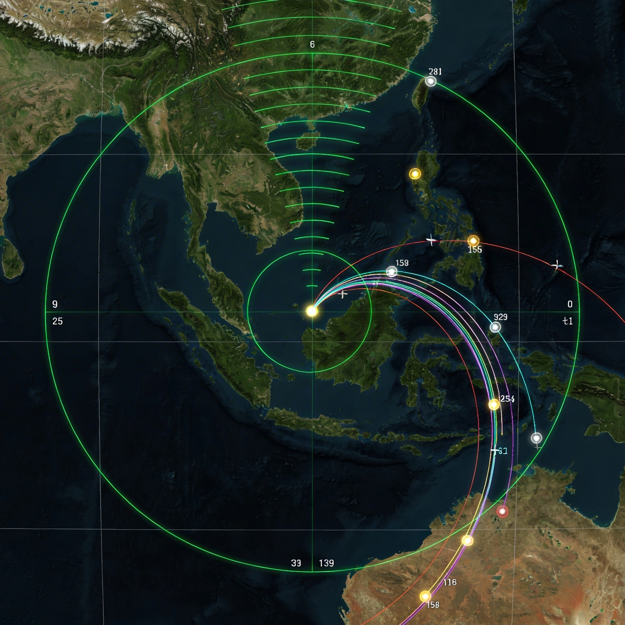
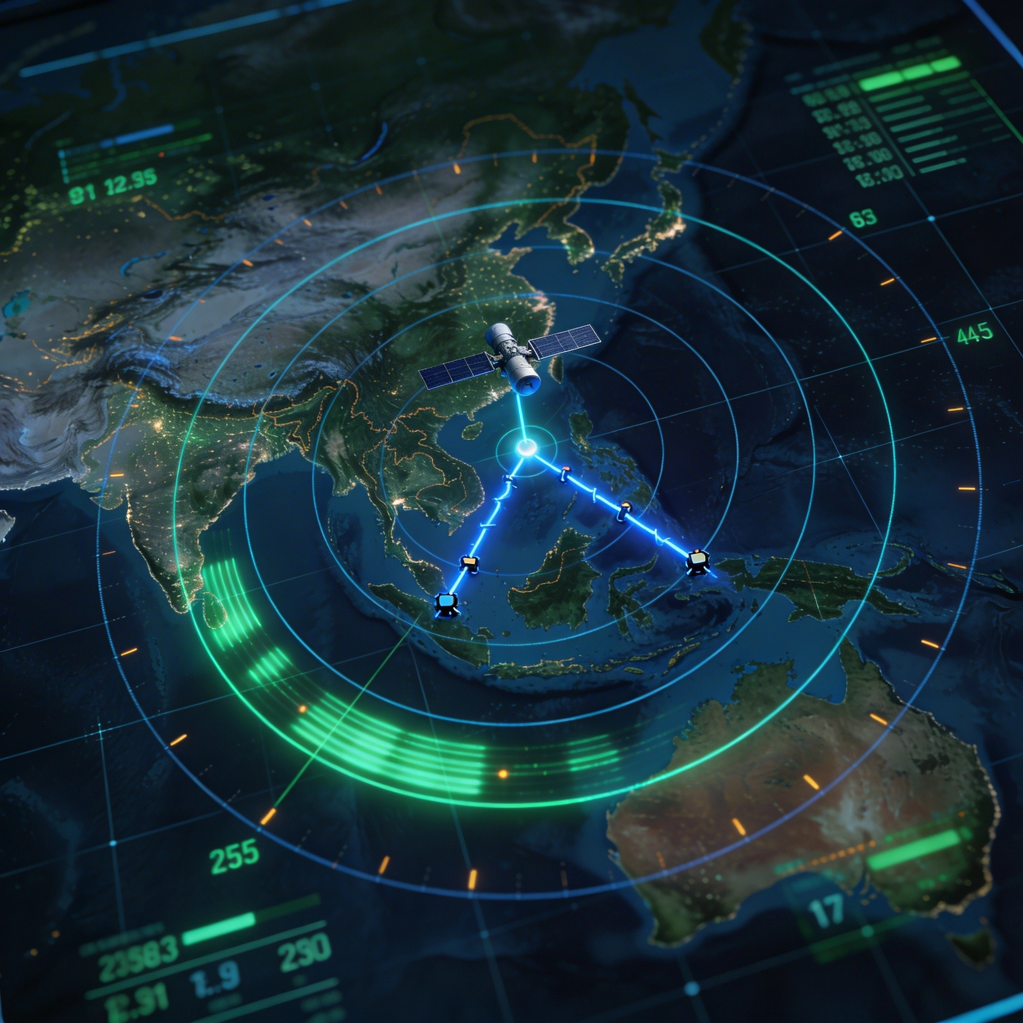
The official reconstruction of MH370's flight path rests on a single data source: seven "handshake" signals between the aircraft's Satellite Data Unit (SDU) and Inmarsat's 3F1 geostationary satellite. These Burst Frequency Offset (BFO) and Burst Timing Offset (BTO) values were used to calculate a series of arcs (concentric circles of possible positions from the satellite) which the Australian Transport Safety Bureau concluded pointed toward the Southern Indian Ocean.
But the Inmarsat data is contested on multiple grounds. The BFO calculations require assumptions about the aircraft's speed, altitude, and heading at each handshake. Different assumptions produce radically different endpoints, some placing the aircraft in the Southern Indian Ocean, others in the South China Sea, and still others in the Bay of Bengal or Indian Ocean north of the equator.
Australia's DSTG (Defence Science and Technology Group) applied Bayesian probability methods to narrow the crash zone, but even their most refined models produced a search area spanning thousands of square kilometers.
Malaysian military radar tracked the aircraft after it turned west, crossing the Malay Peninsula from the east coast to the Strait of Malacca. This military radar track is one of the most contentious elements of the investigation: it shows the aircraft climbing to approximately 45,000 feet (above its certified ceiling), then descending rapidly to as low as 23,000 feet. Forbes argues that this altitude profile is consistent with evasive maneuvering or, alternatively, with an interception event rather than a controlled flight by the crew.
IGARI, the waypoint where the aircraft deviated from its filed flight plan, has generated multiple competing theories. Pilot suicide is the official line. Forbes proposes an external interception. Others point to hijacking, electronic warfare, or mechanical failure. Each theory must account for the transponder shutdown, the westward turn, the military radar profile, and the subsequent Inmarsat handshakes, and no single explanation comfortably accommodates all of the data.

Inmarsat handshake arcs and military radar tracks: competing data sources that produce radically different endpoints
Last ATC contact at boundary of Malaysian/Vietnamese airspace. Transponder ceased at 01:21 MYT.
RMAF tracked aircraft westward across the peninsula. Altitude fluctuations between 23,000-45,000 ft.
7 satellite pings over 6 hours. BFO/BTO analysis produced competing southern and northern corridor arcs.
120,000+ km² of ocean floor searched. No crash site found. Only scattered debris on distant shores.

Flight Path Claims
Military pilots have encountered UFOs displaying impossible flight characteristics
Pilot testimonies, radar footage, military documentation
China has mass-produced quantum radar that is an EPR device.
Ashton Forbes states he reviewed a quantum radar that China has mass-produced showing quantum technologies are real
Military radar capabilities extend beyond publicly acknowledged ranges.
Defense expert testimony regarding over-the-horizon radar systems
Quantum devices use Aharonov-Bohm effect with no classic electromagnetic signal to detect.
Big thing about quantum devices using Aharonov-Bohm effect is no classic electromagnetic signal to detect same reason cannot jam radar.
Nater straight down telescope Earth most useless imagery look at roof building angle object trajectory.
Nater straight down telescope Earth most useless imagery look at roof building want angle profile object trajectory three dimensional space.
Diego Garcia flight logs were destroyed by water damage in July 2014
Official records of log destruction
Roswell crash was likely either intentional deception or shot down by human technology more advanced than assumed
Analysis that advanced tech doesn't equal invincibility, accounts of microwave radar interference
UFO/UAP phenomena represent genuine anomalous craft of unknown origin
Military encounters, radar data, official videos
Sheet of electricity bends parallel radar waves around craft making objects undetectable.
This sheet bends parallel radar waves around craft like water droplet in rainbow making objects undetectable through plasma stealth
China has developed and is mass-producing quantum radars capable of tracking US stealth fighters like the F-22
Article about China's photon detector for quantum radar
The CIA started a fire on MH370 to divert its path.
Testimony from Don Merik and analysis of the plane's trajectory
The MH370 disappearance was a covert US military operation involving the teleportation or annihilation of the aircraft using aneutronic fusion/plasma orbs to prevent technology transfer to China.
Analysis of Gorgon Stare surveillance footage; FOIA request from 2019 linking Gorgon Stare to 'triangle UFOs'; reference to 'Diego Garcia' operations and 'presidential findings'.
Competing Theories
Cargo Induced Assassination
Navy SEALs protecting suspicious cargo from Maersk Alabama were assassinated to silence them about cargo contents and MH370 connection
China-US Tech War Escalation
The theory that China's development of quantum radar represents a major escalation in the technology arms race that could force a geopolitical reckoning. The US may need to either form an alliance with China or take military action before China achieves full advanced technology capability (directed energy weapons, plasma orbs).
Geographical Debris Contradiction
MH370 debris washing ashore in Africa contradicts official South Indian Ocean crash narrative based on ocean current drift patterns proving search area falsity
Lithium Ion Battery Event
Cargo of 221kg lithium ion batteries caused fire/smoke event on plane
Meta Structure Phasing Technology
Meta structure technology creates low complexity phase transitions enabling infinite power transmedium motion faster than light fourth orb destination phasing extraction particle manipulation.
Northern route possibility
Northern route possibility
Southern corridor theory
Southern corridor theory
Total Surveillance State
The theory that the US has achieved total surveillance capability over the entire planet through systems like Gorgon Stare, with AI automatically processing and storing all data permanently. Individual tracking is comprehensive and retroactive deanonymization allows identification of anyone.
US Navy Diego Garcia Diversion
Russian GRU claim that US Navy intercepted MH370 and diverted it to Diego Garcia base in Indian Ocean for unknown purposes involving suspicious cargo